Blog: Community Mapping and Domains of Deprivation
Delali Kumapley, Research Uptake Officer, CHORUS Ghana
Community Mapping and GIS: Application for Health Research – Summary and Reflections from the Webinar
Available statistics show that Sub-Saharan Africa records the highest number of slum dwellers. About 62% of the region’s urban population resides in slums as compared to 35% in Southern Asia (UN-Habitat, 2014). Although this is the case, the population and issues concerning slum dwellers, particularly their health, are masked by the rest of the city and not properly reported.
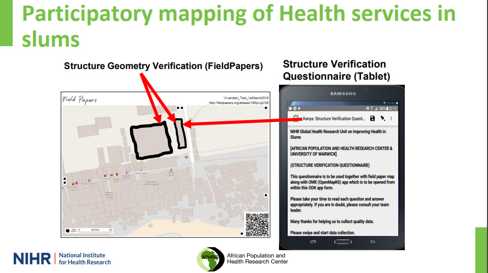
In July 2022, CHORUS organised a webinar on ‘Community Mapping and Geographic Information Systems: Application for Health Research‘ with presentation and discussion with Dr. Caroline Kabaria, an Associate Research Scientist at the African Population and Health Centre. During the webinar, key issues were explored and Prof. Kabaria discussed previous participatory mapping of health services in slums in Kenya. We then explored potential application for CHORUS projects. Watch the presentation here.
Why slum mapping is important
- Slums are often hidden within official statistics of countries while health data collected in most countries are either urban or rural.
- Typically, slums are classified by household wealth but what does it mean if a household is wealthier than the average household in the slum?
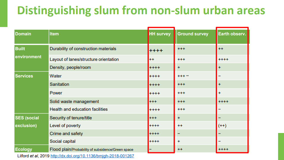
- Beyond household wealth, other domains that are used to measure deprivation in slums include the built environment (durability of construction materials) and availability of services (eg. water, sanitation, power, solid waste management, health and education facilities, social exclusion (level of poverty, social capital, crime and safety) and the ecology.
- The above data could be derived using household, ground and earth observation data and by extension, Geographic Information System (GIS).
- Beyond the socio-economics data of the household, there are other layers that describe deprivation expanding from the household to the environment and the community. These layers can be put onto a geospatial map and can help in the identification of the most deprived areas.
Data Collection in Slum Communities
- Due to the frequently changing nature of slums, eg. The movement of people in and out and changes in the purposes of some households, there is some level of attrition that needs to be factored into the data collection process.
- There is also the cost factor eg. If cities are collecting data from slum communities, can they afford the cost of satellite imagery?
- City departments need to factor in the need for capacity building – how will they engage and build the capacity of slum residents who can help
- When collecting data in slums there is the need to engage various levels of stakeholders – from the government agencies, slum communities etc.
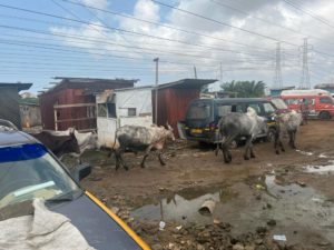
Credit: School of Public Health, University of Ghana. Taken during transect walks for CHORUS